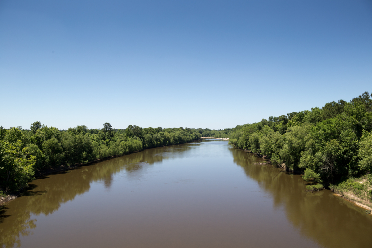
The Pearl River begins in Neshoba County, Mississippi, where several creeks come together including Nanih Waiya. Variously translated as “stooping hill” or “place of creation”, the creek shares its name with a nearby Native American mound central to Choctaw origin myths and venerated as their mother mound. From the swamps of the tribe’s reservation the Pearl flows hundreds of miles south, eventually splitting into two channels, and later infinitely more, forking into marshes and bayous that lead to Lake Borgne and the Rigolets, and then the Gulf of Mexico.
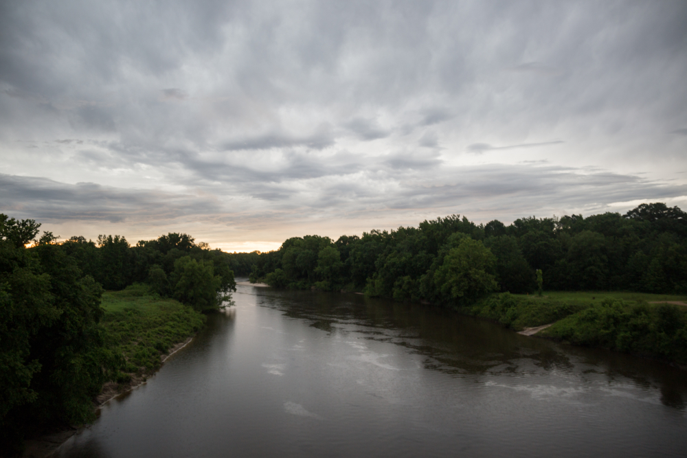
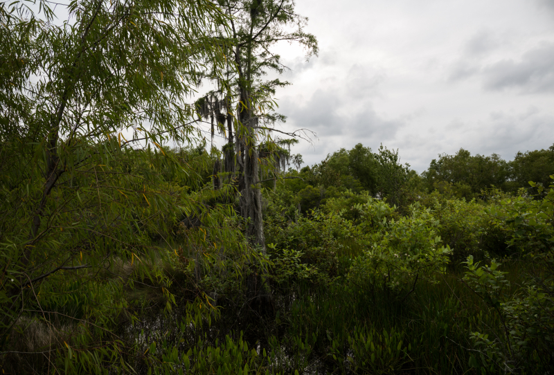
This river presents contrasts and contradictions. There are swamps abuzz with wildlife, where sunlight dapples through leaves of sycamore, cypress, oak, and tupelo, and alligators wait behind tall rivercane. Parts of the Pearl retain a sense of isolation unexpected in a basin with a population of around a million people. Other parts reflect this human presence, including the state capitol, which sits on the river south of the Ross Barnett Reservoir. Built in the 1960s the Reservoir provides residents of Jackson with opportunities for recreation and a steady supply of drinking water. A recently proposed weir, to be constructed between the reservoir and Jackson may further alter the river in this region, and have consequences downstream.
The Pearl River has no concise, singular, description. In this project I set out to show some of the river’s extremes, from its humble beginnings in Neshoba County, to its wide and expansive end near Pearlington. Somewhere in the middle is Red Bluff near Morgantown, a multi-head clay escarpment alongside the west bank of the Pearl that offers vistas of the river valley as well as opportunities to follow one of its tributaries from an underground spring at the base of a canyon to the river’s main channel. These are small pieces of a large puzzle that tell the story of Mississippi’s varied and beautiful environment, as well as the challenges that come along with developing natural resources while also preserving local traditions deeply rooted in place.
Chapters:
Nanih Waiya Creek – Headwaters of the Pearl and Choctaw Ancestral Land
Nanih Waiya Creek is one of many narrow, winding waterways crisscrossing rural Winston and Neshoba Counties, some of which comprise the Pearl’s headwaters. The area hosts several sites sacred to the Choctaw, including the aforementioned Mother Mound, Nanih Waiya, as well as the mouth of a cave near the creek, which serves as a point of origin in Choctaw legends. Several small burial mounds originally surrounded the 25 foot tall mound, but farmers have since plowed and leveled the area.
In 2008, the state returned the land to the Choctaw who had lost it in 1830 with the signing of the Treaty of Dancing Rabbit Creek.
According to the Neshoba Democrat T. W. Luke, Jr. owned the mound and the land surrounding it until he deeded it to the state of Mississippi for the creation of a state park in the 1950s. The State Park Commission built a pavilion and picnic tables across the street, but the rural area attracted few visitors and slowly fell into disrepair. In 2008, the state returned the land to the Choctaw who had lost it in 1830 with the signing of the Treaty of Dancing Rabbit Creek.
“I think they were running out of money to maintain all the state parks and that’s part of the reason why they gave it back,” said Martha Ferguson, Cultural Liaison at the Chahta Immi Cultural Center. “The land surrounding the mound is privately owned, but we can park our cars across the street and visit. We had a celebration the year it was returned, and continue to have one every year in August. We were just so happy to have had it given back to the people.”
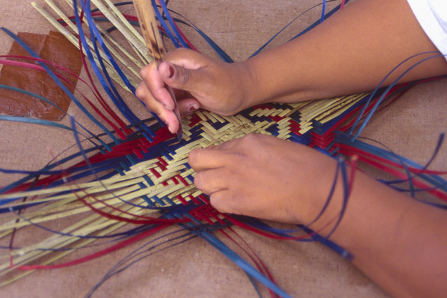
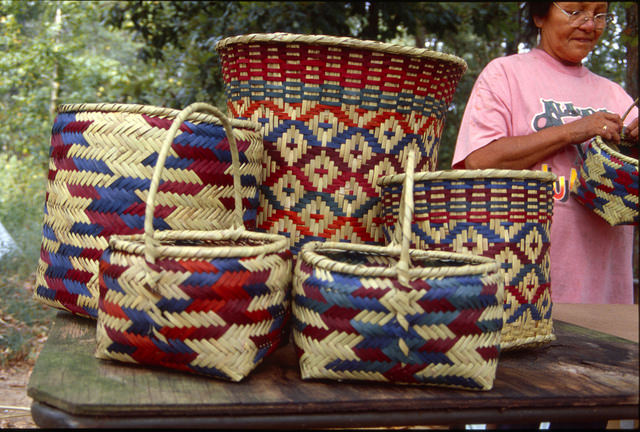
At the Chahta Immi Center, exhibitions tell the story of Choctaw song, dance, sport, clothing, foodways, and other cultural traditions. Two exhibitions of pottery and basketry illustrate the intimate ties between the nearby rivers and creeks and the tribe’s material culture. “Choctaw make baskets from river cane, or swamp cane,” said Ferguson. “It grows alongside the water and it’s tall and green, but not like bamboo. That’s hard to work with, but some people do make fishing poles or blow guns from bamboo.”
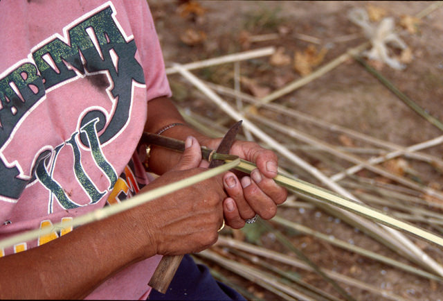
Basket makers travel into swamps to cut cane across this part of the river basin. “They say, ‘I have to fight with the snakes to get this cane’,” said Martha. “It’s actually getting harder and harder to find river cane. When people come across it, once every month or two, people will hurry to cut it and make baskets.”
Mississippi State University and the EPA initiated a river cane restoration project with the Choctaw in 2008, working to rebuild canebrakes, or large stands of river cane, that once covered millions of acres of the southeast. The plant declined due to overgrazing, agriculture, and urban encroachment. Native Americans across the region used the cane for thousands of items – everything from baskets to coffins. “Fresh river cane is like rubber when it’s green: strong and flexible,” said Ferguson. “Over time it tans and dries, after you’ve assembled the basket.”
Martha Ferguson doesn’t weave baskets, and she emphasizes that to really understand the craft, you have to meet with one of the makers. The tribe offers those curious an opportunity to do that annually on the first Saturday of each May, when they celebrate the art. “We bring young and old basket makers, and they demonstrate how to strip the cane. You strip the cane more than once, and then there are also different dyes and different patterns that they use,” she said.
Historically, when the Pearl River was the area’s primary thoroughfare, Choctaw routinely traveled up and down its length, trading with other tribes and later with European colonists. Creole families in New Orleans, and in Mandeville on the North Shore, used Choctaw baskets as laundry hampers and to store kitchen cutlery. Choctaw herbs like filé became part of Creole dishes including gumbo.
Choctaw pottery also came from the river, made from clay typically gathered at the banks. “Our pottery is beautiful work,” said Ferguson. “We don’t have many people left who do that. Grady John was a great potter. He gathered clay from the banks of the Mississippi; he lived in Memphis. Before he passed away in 2002, he came and visited and showed the kids how to make the pottery. He also taught another Choctaw woman in Memphis who still makes things, Laura Solomon.”
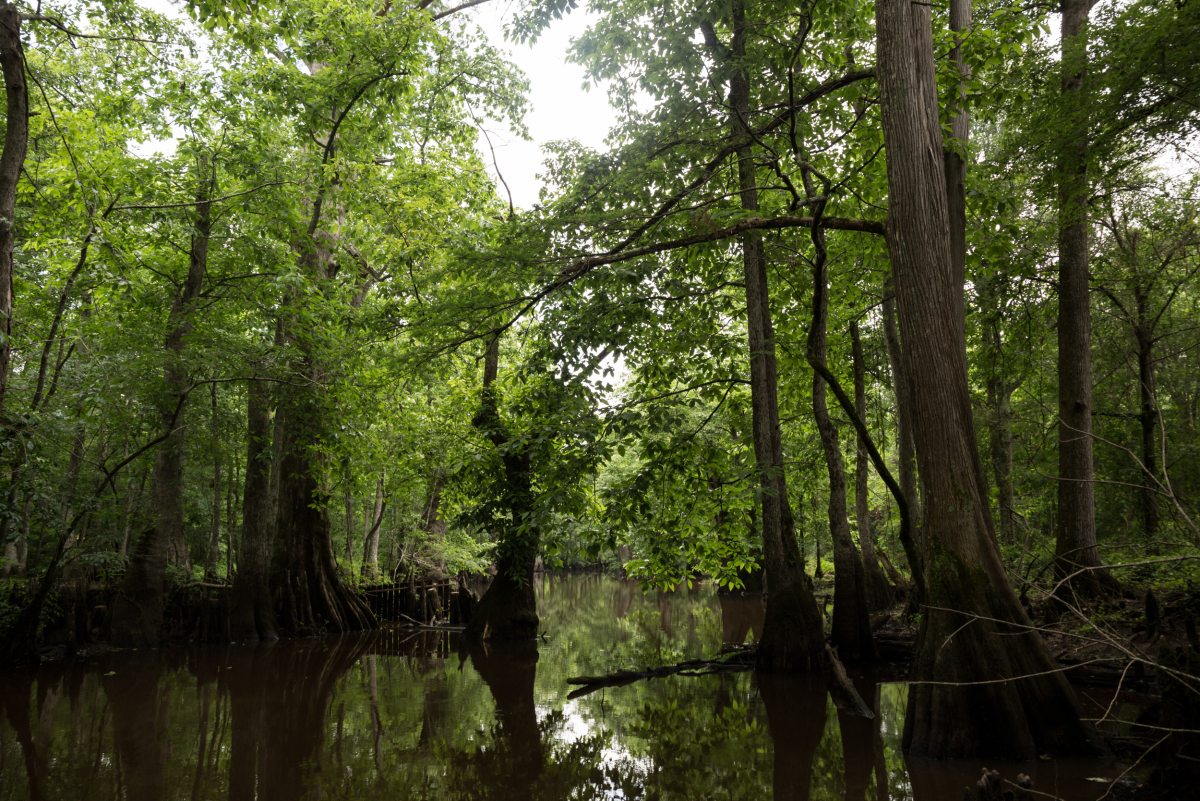
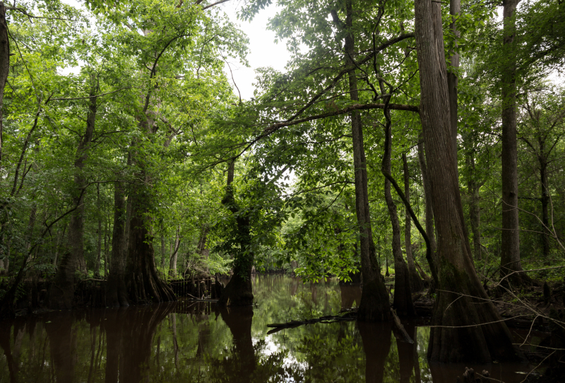
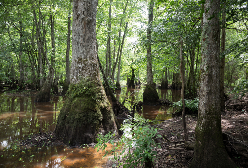
John and Solomon both have items on display at the cultural center, typically deep brown or black in color, and often representing animals found in the region including ducks, crawfish, and possums. Isolated parts of the river delta teem with wildlife, including the bulk of the swampy headwaters where the Choctaw reside today. The area is also known for its wildflowers; hundreds of species bloom seasonally.
Red Bluff Creek – Tributary of the Pearl in Mississippi’s Grand Canyon
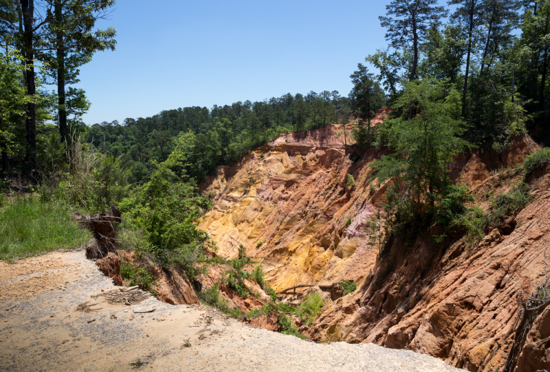
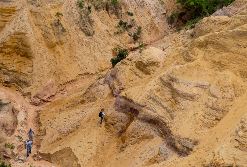
Red Bluff looks different every time you visit. Depending on the angle of the sun, and the timing of the last heavy rainfall, you might see white, yellow, orange, red, purple, and/or pink streaks crookedly making their way to the base of a canyon hundreds of feet below. At the bottom, a small creek emerges, and its fresh, cold, water eventually reaches the main channel of the Pearl, whose west bank previously eroded the bluff’s base. Presently, erosion continues, as heavy rains push dirt and parts of former highway 587 over the western edge, and water underneath the base comprising Red Bluff Creek slowly moves dirt and rocks out of the canyon. All that erosion means the shape of the landmark also routinely changes. It’s getting bigger.
“When I was a kid we used to hang over the side with our legs straight out and slide down to the bottom,” said D. O. Wesley, who runs a honey farm in Foxworth, Mississippi. “I’m 84 years old and the bluff looked a lot different then. People did all kinds of crazy stuff. Kids riding the roads like chickens with their heads cut off. You’d hear stories of cars going over the side…sometimes people wanting to end it all.”
All that erosion means the shape of the landmark also routinely changes. It’s getting bigger.
The bluff is in the middle of scenic country, with plenty of pine trees, wildflowers, and rolling hills. People often end up there after long weekend drives, taking a peek over the side and into the distance before heading back home. More adventurous visitors follow a well-worn but steep path down the bluff’s side, following the creek at the base west towards the Pearl or east into the base of the bluff. During average or low water levels, a large sand bar extends out from the bank where the creek and the river meet. I visited during high water, when murky water from the Pearl backs up into the creek bed. A boater taking advantage of the newly navigable channel warned me not to try and reach the sand bar. “The water’s deep through here, and the bottom’s like quicksand,” she said, gesturing back toward the main channel. “And you never want to swim out there. You can’t predict the currents.”
Visitors regularly find their way to the bluff, although state and local officials don’t promote it. “It’s private land so the state can’t advertise going to it, but the people that own it don’t stop visitors,” said a Morgantown resident who lives near the bluff. “We don’t know if people are legally allowed to go there or not…I never know what to tell people. I know there are campfires out there and people are always there. I have people pulling over all the time to ask me how to get there since the state took the signs down.”
Pearlington – The Lower Pearl and its Surrounding Marshes
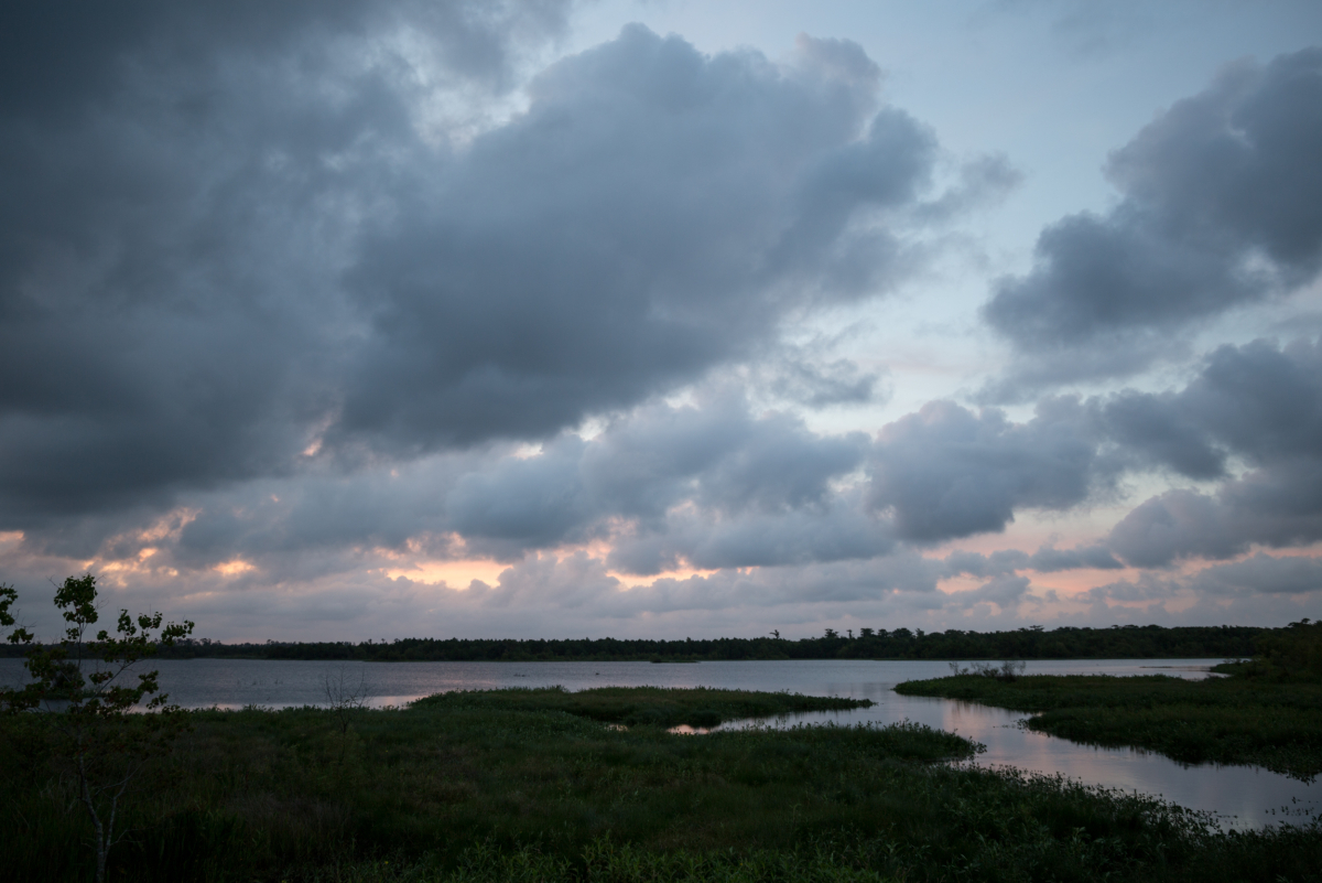
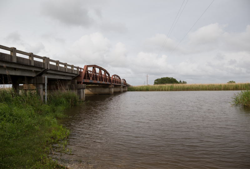
At Red Bluff the Pearl is still a single channel, growing wider as it moves south and absorbs the flow of numerous streams and rivers. Below Bogalusa, the river begins to split. “It’s a completely different river down there,” said Stan Little, of Mendenhall, who camps and fishes on the upper Pearl. “We have forests, and they have marshes and bayous.”
Ernest Herndon, author of Canoeing Mississippi and an expert on the state’s rivers, echoes those sentiments and adds, “you don’t want to tackle the lower Pearl without maps, unless you have a few days to be lost. I usually stay lost for days, intentionally. Me and a guy paddled from the Bogue Chitto into the Honey Island Swamp. We would see a channel and off we would go, like Alice in Wonderland. These were little waterways, winding through virgin forest with towering longleaf pines and crystal clear waters. Eventually we emerged at the coastline.”
The small town of Pearlington serves as one entry point to the lower Pearl, sitting on the east bank of the east Pearl River. (The west Pearl is in Louisiana at this point, but it starts getting difficult to tell where Mississippi ends and Louisiana begins, especially when traveling by water). Pearlington also served as Hurricane Katrina’s Mississippi landing point, decimating the community of around 1,700 and leaving only two buildings undamaged.
“The storm blew Pearlington away. It pushed a thirty foot wall of water up the Pearl River, and completely rerouted the surrounding marshes and bayous, “said Herndon. “The map you would use to navigate prior to 2005 was irrelevant, and the impacts of the storm went far upriver.”
Today, Pearlington continues to recover. Camps are being built along the Pearl, and the relaxed atmosphere at the town’s only restaurant, Turtle Landing, makes the storm seem like a distant memory. Empty foundations in overgrown yards, with leaning mailbox posts out front, serve as concurrent reminders that hundreds of residents left the town after Katrina and never came back.
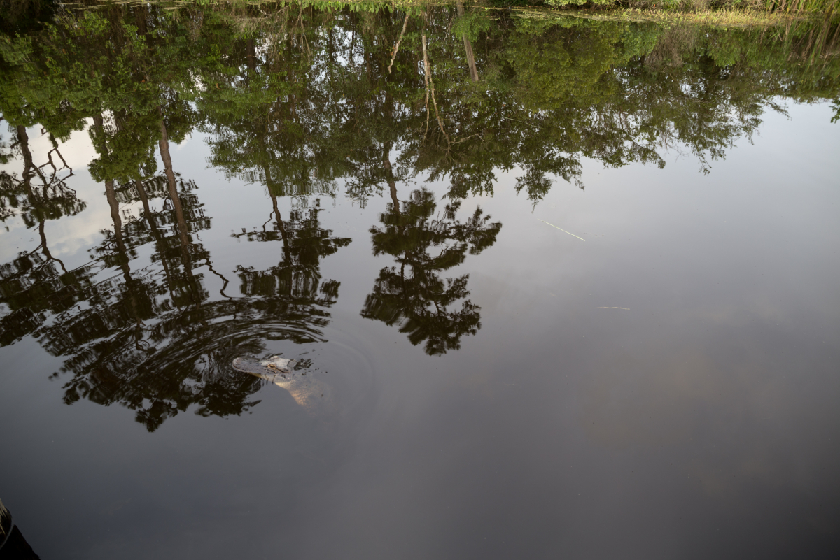
There are several wildlife management areas nearby, where people run trot lines and catch catfish, or hunt for boar, nutria, deer, and alligator. “We’ve got a ton of alligators around here,” said David Simmons, Turtle Landing patron. “They’ll start climbing up onto the dock behind the restaurant and someone has to catch them and take them back to the East Pearl.”
Customers drinking beer outside sometimes throw snacks to waiting alligators, encouraging them to come closer. When the Pearl’s water is high, it backs up into the surrounding bayous, which reaches the Turtle Landing parking lot, where alligators swim alongside parked cars.
The abundance of waterways and wildlife make swamp tours a profitable area enterprise, though most of that business is technically on the Louisiana side of the river. Commercial fishermen, shrimpers, and oystermen also live in the region and make their living where the river meets the Gulf. Funded with BP restoration money following the Deepwater Horizon spill, a $50 million project creating new marsh and rebuilding damaged oyster bottoms begins at the mouth of the Pearl and extends six miles east toward Bayou Caddy in Hancock County.
Economic enterprise and environmental restoration efforts on the lower end of the river sometimes come into conflict with projects upriver. Dams disrupt the upstream movement of saltwater species that spawn in freshwater rivers, and typically decrease the amount of freshwater that makes it downstream. One of Herndon’s most vivid memories of the Pearl recalls a gulf sturgeon that made it from the mouth of the river into Pike County on the Bogue Chitto.
“Sturgeon are endangered, so they’re rare anyway, and on top of that sills and dams often keep them from being able to reach this part of the Bogue Chitto, but one day a group of paddlers encountered a 200 pound sturgeon, who probably made it over the sill during high water, and they managed to wrestle the fish to a shallow part of the river and take pictures with it. Then they let it go. The sturgeon was over seven feet long, and swimming just underneath their boats,” said Herndon.
As environmental advocates downriver encourage the removal of weirs and dams, some lawmakers and businessmen upstream promote the installation of further impediments to the Pearl.
After sturgeon spawn upstream, they return to the Gulf, illustrating the interconnectedness of seemingly incongruous parts of the river. As environmental advocates downriver encourage the removal of weirs and dams, some lawmakers and businessmen upstream promote the installation of further impediments to the Pearl. “There have been projects to dam the river in Jackson for decades,” said Herndon. “Thus far they’ve always been halted, largely due to resistance downriver.”
A current project, named One Lake, includes the installation of a weir near Jackson to slow the flow of the river and ultimately create a 1,500 acre lake. Environmental groups representing the Lower Pearl have already stated their opposition to the project, and await a promised environmental impact study. Swamp tours guides, oystermen, and fishermen, people who make their living in the swamp, have also expressed concern. “These back channels are one to two feet deep, and if the water level drops much, we won’t be able to get back there. So, how do I give a swamp tour?” said Neil Benson, owner of Pearl River Eco Tours. “What happens to the Honey Island Swamp?”
Proponents in Jackson focus on the need to prevent future flooding in the area, and argue that the lake won’t have an impact downstream. The needs of a community living in one area of the river may not always align with the concerns of those downstream. The best decisions arise out of a holistic view of a system comprised of very different parts. Flood control in Jackson can’t come at the expense of recovering oyster beds in the Mississippi Sound, just like the health of the sturgeon population can’t supersede flood control efforts in Picayune (or Jackson).
After centuries of human settlement, as well as natural and manmade disasters, the Pearl remains a vibrant river basin. “I paddled the Honey Island Swamp a few months after Katrina, when the area had just been twenty feet underwater,” said Herndon. “I saw alligators, wild boar, nutria, and there were birds everywhere. I’m not saying the storm didn’t have a huge impact, I’m sure it did, but the animals were back…it’s a special place.”